Preview image. Unlock full-res
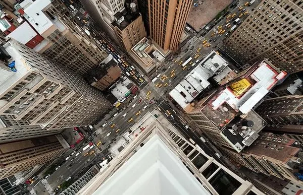
A high-angle, top-down view looking down from a skyscraper onto a busy city intersection surrounded by tall buildings.
Summary
A high-angle, top-down view looking down from a skyscraper onto a busy city intersection surrounded by tall buildings.
Visual description
The image features a vertical perspective looking straight down from a white building corner onto a grid of streets. Numerous yellow vehicles and grey cars move through the intersection between dense, multi-story brown and grey buildings. The composition is dominated by strong diagonal lines created by the building edges and street layouts.
Key takeaway
Use extreme high-angle perspectives to create a sense of scale and geometric complexity in urban environments.
Reuse notes
Ideal for backgrounds in real estate marketing, urban planning presentations, or cinematic city sequences.
More like this
Keep what you find
A free account saves references to boards and can send you a weekly email of picks based on what you save.
To see every result, go Pro.