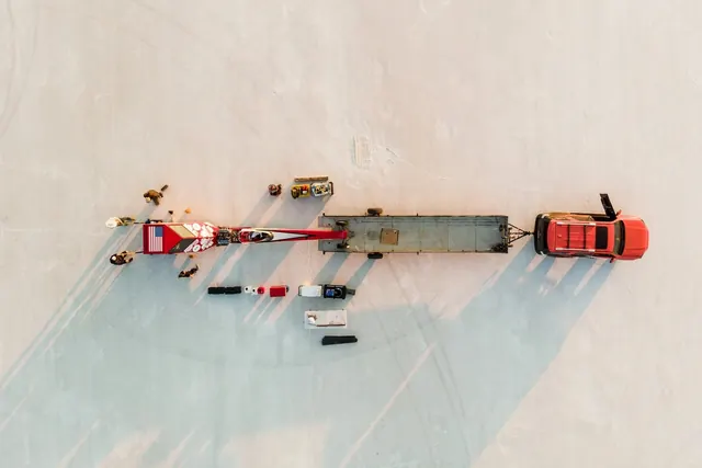
Preview image. Unlock full-res
Overhead drone photograph of a highway accident scene with vehicles, emergency services, and scattered debris on a light concrete surface.
Summary
A drone aerial view of a highway accident showing emergency response with vehicles, personnel, and debris arranged along a multi-lane road.
Visual description
Overhead bird's eye perspective of a concrete highway. A red emergency vehicle and other cars are positioned at angles suggesting an accident. Scattered debris and objects are visible on the road surface. Emergency responders in bright clothing appear as small figures. Multiple vehicles and equipment form a linear composition across the frame. Road markings and lane divisions are visible. The neutral concrete surface is bathed in soft ambient daylight creating subtle shadows. The composition reveals the human scale and spatial relationships typically invisible at ground level.
Key takeaway
The power of overhead perspective to show systems and scenes unavailable at eye level, revealing scale, spatial organization, and the relationship between elements. The neutral palette keeps focus on the documented event.
Reuse notes
Effective for documentary photography, news media, emergency response documentation, or conceptual design exploring scale and perspective. The aerial perspective creates psychological distance appropriate for sensitive subject matter. Works well for technical or administrative documentation. Drone photography offers unique narrative opportunities not available from the ground.
More like this





Keep what you find
A free account saves references to boards and can send you a weekly email of picks based on what you save.
To see every result, go Pro.