Preview image. Unlock full-res
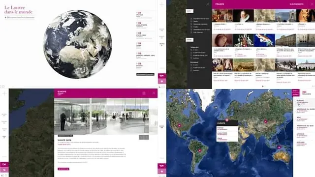
A collection of four UI screens showcasing a global map-based interface for a museum, featuring satellite imagery, location markers, and content grids.
Summary
A collection of four UI screens showcasing a global map-based interface for a museum, featuring satellite imagery, location markers, and content grids.
Visual description
The design uses high-resolution satellite imagery of Earth as a primary background element. Content is organized through clean white grids and magenta accent bars, paired with photographic thumbnails. Typography is minimal and sans-serif, providing a structured, editorial feel.
Key takeaway
Use large-scale geographic imagery as a central navigation element to create an immersive, global context for content.
Reuse notes
Ideal for travel, cultural heritage, or global logistics websites that need to visualize presence across different regions.
More like this



Keep what you find
A free account saves references to boards and can send you a weekly email of picks based on what you save.
To see every result, go Pro.