Preview image. Unlock full-res
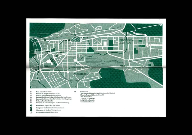
A detailed cartographic map rendered in vector style with teal green, white, and grey color blocking to differentiate zones, neighborhoods, and infrastructure.
Summary
A detailed cartographic map rendered in vector style with teal green, white, and grey color blocking to differentiate zones, neighborhoods, and infrastructure.
Visual description
A city plan rendered entirely in vector, with sharp lines and solid color fills in teal green, white, and neutral grey. Road networks appear as fine white lines subdividing rectangular blocks; green zones indicate parks or open space. Labels in clean sans-serif sit left-aligned in small blocks along the border. The palette is restricted to cool, desaturated tones, creating a systematic, legible hierarchy that emphasizes the clarity of the planning data over visual flourish. High contrast between light grey background and dark teal shapes ensures readability at any scale.
Key takeaway
The constraint of a limited three-color palette (teal, white, grey) supporting complex cartographic information without clutter. The technique of using color blocking to distinguish land-use categories and roads in a single, unified visual language. The margin-aligned typography treatment keeps the frame clean and anchors contextual information.
Reuse notes
Essential reference for urban planning graphics, transportation maps, GIS visualization, and any technical cartography where clarity of data hierarchy matters more than aesthetic ornamentation. Works well when a single, bold accent color (like teal) anchors multiple neutral zones.
More like this






Keep what you find
A free account saves references to boards and can send you a weekly email of picks based on what you save.
To see every result, go Pro.