Preview image. Unlock full-res
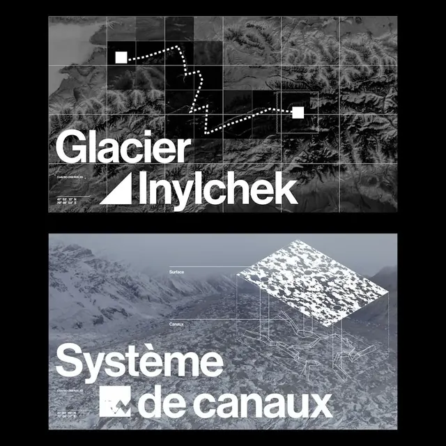
Two-part editorial layout showing satellite topography and hydrological systems in stark black-and-white grid and 3D visualization.
Summary
Two-part editorial layout showing satellite topography and hydrological systems in stark black-and-white grid and 3D visualization.
Visual description
Upper section displays a gridded satellite/topographical view of glacier and mountain terrain with white dotted path lines overlaid tracing a route or flow pattern; bold white sans-serif "Glacier Inylchek" label anchors lower left. Lower section shifts to 3D wireframe visualization of a snow-covered mountain surface labeled with "Systeme" and "de canaux" (system of channels), showing surface contours and subsurface drainage geometry. Both sections use pure black background, white/grey imagery, and minimal labeling; the monochromatic palette and geometric grid reinforce scientific precision.
Key takeaway
The editorial logic of pairing satellite/orthographic view with 3D interpretation to explain a complex natural system; using gridlines and dotted paths to guide visual hierarchy and suggest data flow; minimal type letting the imagery dominate while remaining perfectly legible.
Reuse notes
Ideal for environmental, geological, or scientific editorial content. The stark monochrome treatment conveys expertise and seriousness without requiring color. Works well in academic publications, research presentations, or editorial features on climate, geography, or hydrology topics.
More like this




Keep what you find
A free account saves references to boards and can send you a weekly email of picks based on what you save.
To see every result, go Pro.