Preview image. Unlock full-res
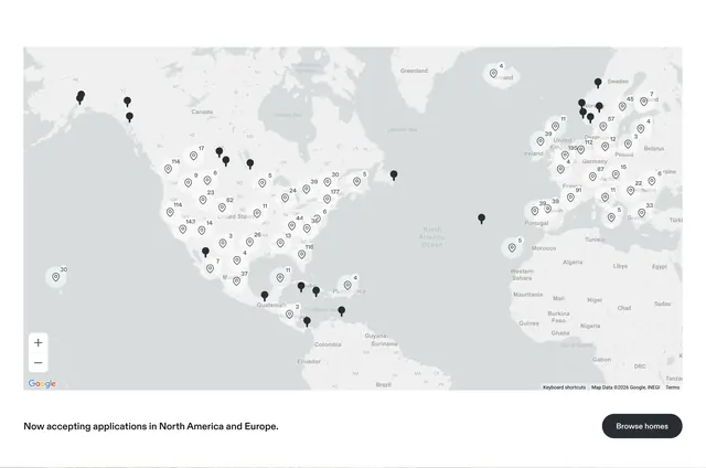
Custom gray Google Map with clustered listing pins across North America and Europe plus a browse-homes CTA bar.
Summary
A desaturated world map showing Kindred home density via numbered cluster bubbles and single pins, with an applications announcement and browse CTA below.
Visual description
Full-width custom-styled Google Map in grayscale focusing on North America and Europe. White circular cluster markers with pin icon and counts (177, 143, 195, etc.) over dense US and European cities; individual black pins in sparse regions. Standard zoom controls bottom-left. White footer bar: left text "Now accepting applications in North America and Europe."; right black pill "Browse homes" button.
Key takeaway
Stripping map color to gray keeps focus on density data, not terrain. Pairing the map with a plain announcement bar avoids overlay clutter on the map itself.
Reuse notes
Marketplace or travel networks proving geographic reach. Requires live map data and performant clustering. Grayscale styling needs accessible contrast on markers.
More feature detail sections
See all









More like this




Keep what you find
A free account saves references to boards and can send you a weekly email of picks based on what you save.
To see every result, go Pro.